
Disclaimer – the events described in this post have the potential to be extremely dangerous. This trip was undertaken with local knowledge, relevant experience, safety equipment and an informed risk assessment. I recommend that you do not attempt it.
Sea kayaking into the unmapped corners of Moricambe Bay in search of two first Geographs before the tide closed the window.
I wrote about Geographing back in November, in Taking the “Y” off Geography – a Morning on the Solway. I’m part of a wholesome community gradually photographing every one-kilometre grid square in Britain and Ireland: a sort of manually assembled Street View for the places Google’s cars cannot reach.
After twenty years, most of the straightforward squares have been captured. I happen to live near roughly two hundred that have not, and chip away at them when time permits.
My last effort involved monitoring the tides and jogging 1.6 miles over the seabed in the general direction of Scotland. I came away with four first Geographs. For my second go, after several months of studying maps and tide tables, I settled on Moricambe Bay.
The Bay
I can see the bay from my house. It is a long way off, but I can tell whether the tide is in or out. I often walk my dog to Grune Point, the tip of the spit of land at the top. From there, across the water, you can see Anthorn Radio Station, a Cold War-era defence establishment that literally glows red in the dark.

To the right of the transmitters, about 1km out, several vertical timbers stick out of the water, like the remains of a bridge or a pier.

There is a WW2 pillbox just back from the shore. You can see across to the Dumfries coast. It is a liminal place. It looks different every time I see it. I enjoy the exotic flotsam. There is a blurred transition from farmland to seabed. Every time I visit, I study the tide tables and watch the flow and direction of the currents. They are fierce: the tidal range here is up to 10.6 metres, funnelled into a narrow bay. There are no Admiralty charts this far up. It is not supposed to be navigable.


The bay itself is fed by two main rivers: the Wampool from the east and the Waver from the south, as well as smaller streams such as Skinburness Creek from the west. It is at least arguable, and I have convinced myself, that the source of a tributary to the Waver is next to our house.
You can find the bay instantly on any map of the British Isles. Look for the bulge of St Bees Head, follow the coast up towards Scotland, and just before the Solway Firth narrows you will see it on the right, shaped like an asymmetrical droopy moustache.

When the tide is out, the river channels and mud make it all but impossible to explore on foot. The bay contains twelve 1km grid squares, five of which had yet to receive a first Geograph.

I hatched plans to get into them with my sea kayak. My main objective was NY1755, a plot of marshland to the east of Newton Arlosh, right at the bottom of the bay. I marked up a paper OS map with a few other targets and then it was just a case of waiting for the right combination of weather, tide and free time.

Execution
On Sunday afternoon, my ducks were finally lined up. My friend and longtime kayaking buddy Nick was staying and we needed a quick local adventure.
We set off from Silloth at about 1pm. High tide was due at 2:55pm, and the forecast was Beaufort F2, a gentle breeze from the west. It felt much calmer than that.


We had to skirt wide around the sand bar that runs north from the start of Grune Point, not quite having to use our knuckles on the sand. Kayaks feel fairly sluggish in shallow water, so we were relieved to enter Moricambe Bay.


I should have headed straight for NY1755, but the vertical wooden structures in the middle of the bay caught my eye. I’d been curious about them for a very long time, so I temporarily abandoned plan A and made a beeline for them. As we got closer, we realised there were Great Cormorants nesting on the posts. I counted about sixteen vertical timbers, most with a nest on top. The wood was stained white with guano.

We changed course a little so as not to disturb them. Although we had not been too aware of the tidal flow until then, the static timber gave us a reference point as we were pulled sideways into the bay at walking pace. There was turbulence in the water around the foot of the posts. I timed it so we would reach them close to high tide, when the flow should have been easing. Definitely not a place to be at peak movement.
I grabbed a couple of GPS-tagged stills with my tough camera and we headed north.
As we approached Anthorn, I realised the foreshore to the south was still out of the water. Someone else had already bagged that square, so we pressed on to another sand bar just south of Cardurnock.
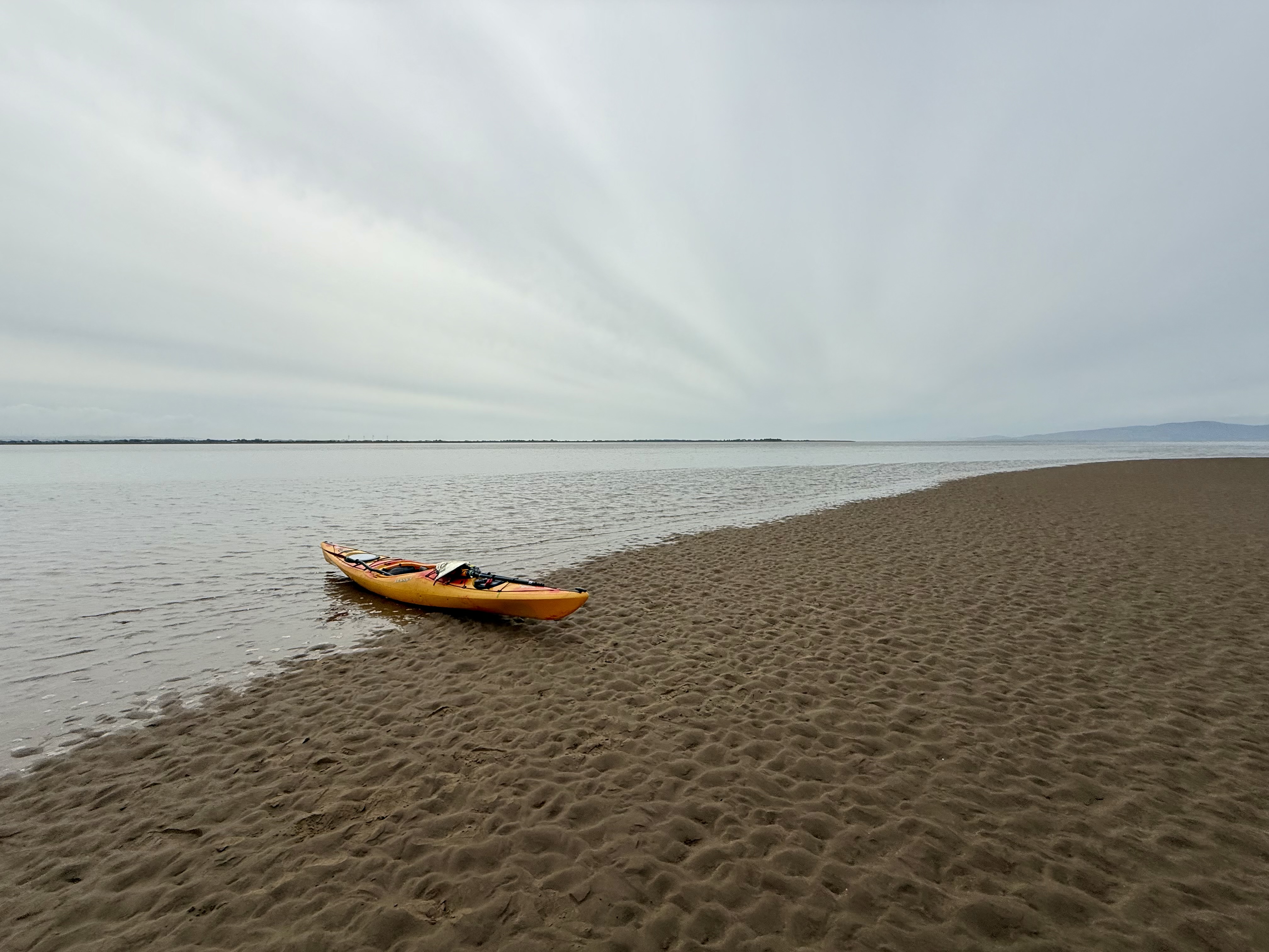
The sand was the colour of Earl Grey, mostly gritty but with a hint of estuary mud. It felt solid underfoot.

I checked my mapping app. I’d already marked all the unclaimed geographs, we were right inside one so I snapped away happily whilst Nick dug some chocolate out for us both.

In the 5 minutes it took me to take the photos, the sea reached and floated my empty kayak.

We decided to paddle due south, still hoping to reach our original target. About 1.5km short of it, we ran out of water. From a kayak, sat almost on the surface, wet sand and shallow sea can look much the same. This was not a shallow patch but a substantial sand island. Going round it would have meant another 1.5km or so of paddling, with no guarantee of finding a channel or getting out of the bay afterwards. As it happened, the island itself had never been photographed, so I decided to make the most of it and got out for a walk. It was solid enough, though softer than the previous sandbar.

It occurred to me that I might just be able to set foot in NY1755 if I ran to the far side, but I would have to be quick with the tide on its way in. Nick stayed in his kayak, with mine clipped to his by a short tow rope. If I misjudged the rising water, he would be able to paddle over to me.

Jogging and taking photos as I went, I reached the far end of the island. I was still 300m short of my target. We were separated by a deep channel. I was disappointed, but after a very quick spot of mapwork I realised I could still get the unclaimed square to the west, the gridline appeared to be slicing the end off the island I was stood on.
At this scale, on such featureless ground it’s almost impossible to determine a grid boundary other than by GPS. As I reached the invisible line, I realised the sea was just outside of it but coming in fast. You can’t claim a geograph unless some dry land is visible within the square. I waded out 10m or so into the shallow water and took a photo looking back. It wasn’t very good, but it would have to do for now.

I was now about 300m or so from Nick and the boats. I could see they were afloat. I jogged back over, very excited to have collected two first geographs. These felt like a bigger prize than the one I’d originally set out for – transient offshore sand features that might not exist for the next geographer to try.

I got back into my kayak and we made haste to get out of the bay whilst there was still enough water.
The sea had picked up quite a bit whilst we were in the sheltered bay. It made for quite an enjoyable paddle back to the car. One hour after high tide we were driving home, mission safely accomplished.
I didn’t quite manage to get NY1755 this time, but I’ve proved to myself that it can be done. Next time I’ll bring a bit more discipline and head straight to it.
I must take pains to urge you not to try to explore this bay unless you either really know what you’re doing or are being guided by someone who does. We had the benefit of a good practical grounding in sea kayaking, copious safety gear, a degree in geography, local knowledge and a fair bit of experience managing risk. A lot can and does go wrong on this stretch of coast.
Resources and further reading
If you are curious about the equipment used on this trip, take a look at my kit list.
Anthorn Radio Station – a Cold War era radio transmitter system on a former Royal Navy airstrip. Still in use now for communicating with our submarines.
Anthorn gate street view – you can’t get into this sensitive site.
Solway Coast National Landscape – the wildlife, geography and history of the bay.
Substack blog about Grune Point – a different and excellent take on this location by Angie Dawn.
Remains of Grune Point bombing range – an explanation of the wooden structures in the middle of the bay by the Silloth Airfield history team.
Geograph.org.uk to learn more about this remarkably satisfying hobby.
Leave a Reply