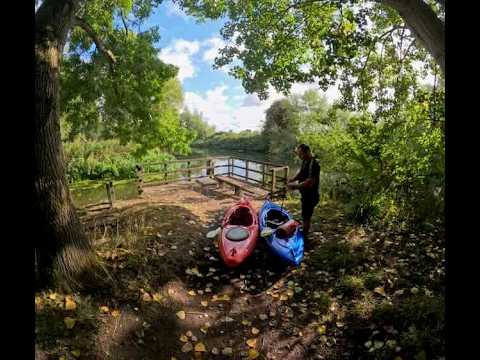
From 60 metres out, I started to think that maybe the group of people on the beach might be naked. Their bodies were a remarkably consistent colour, all of them. Not a hint of fabric.
There was nowhere else for us to land so we paddled closer.
Yep. Definitely naked. Three generations by the look of them.
A hirsute, confident lady in her fifties sat on the pebbles, arms back, palms on the ground, legs bent at the knee. She was pointing it directly at the setting sun.
We ignored them as best we could and aimed for the opposite end. They all stared at us as if we were the weirdos!

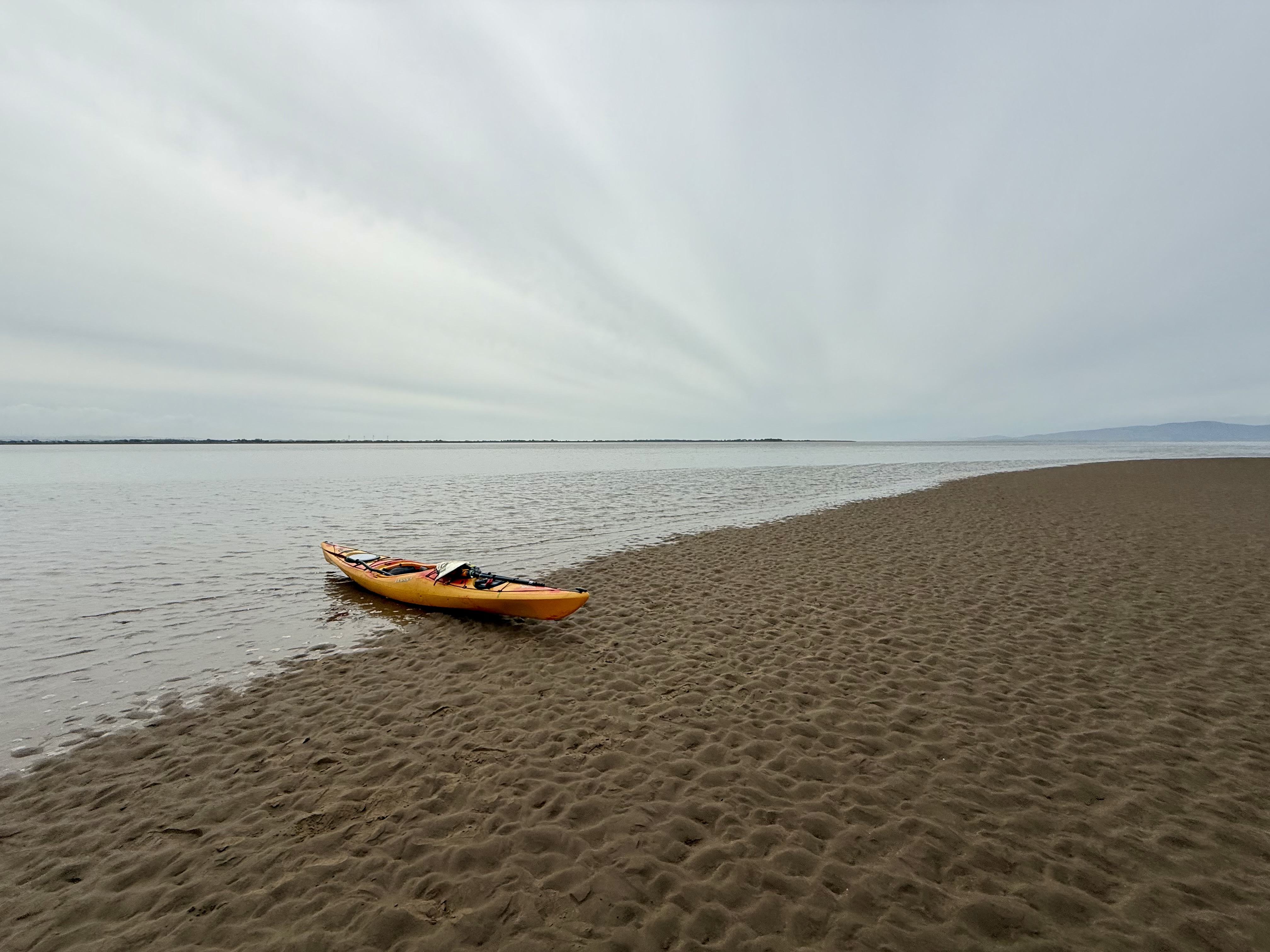
The beach was made of rounded-off white cobbles, peaty soil and a little orange sand. With so little tidal movement, there were established plants dotted all over.
We pulled the kayaks to the tree line and put our tents up. After about 45 minutes the nudists departed – swimming back to a chartered yacht anchored in the bay.
We now had the place to ourselves; we celebrated with a swim and many cans of beer.
This was only day two.

Planning your own kayaking trip to Croatia?
This is the story of five days exploring the islands around Split with my friend Nick.
If you’re more interested in the practicalities, you can skip straight to the costs, equipment and advice at the end.
Forty-eight hours earlier, Nick and I were tucking into a shepherd’s pie at his place in Bedfordshire, poring over weather forecasts and maps. We had booked a five-day self-guided sea kayak expedition with Red Adventures, a company based in Split, Croatia. They would provide us with kayaks, camping kit, maps and local advice. We were already on version two of the route owing to a substantial wildfire on the island of Brač. There was a stream of WhatsApp messages flying back and forth between me and Dejan, our guide.

Our flight was at 0620. As we approached Split airport, I recognised all of the places we planned to paddle to out of the window.

Nick can’t remember much about that.
We were met by Mario from Red Adventures. I had wondered how we would recognise him, half expecting a man with a sign saying Robert and Nick. But actually, it was a Vauxhall Vivaro with two upturned sea kayaks on the roof that led us to him.

He dropped us off at Lidl so we could stock up on essentials. This was mostly beer and water, suncream, crisps, snacks and some tins of fish just in case.
The Red Adventures kit was then explained and handed over: two sleeping bags, two roll mats, two kayaks, three paddles and one tent.
“Wait a minute,” I said.
“We ordered two tents.”
A look of confusion swam across Mario’s face. He’d imagined this was a very different kind of trip. He drove back to Split to fetch us another tent while we put everything into dry bags and set up the kayaks.

They were decent boats. Well used but strong and plenty of life left in them. They had rudders which neither of us had used much before. We managed to fit everything in with space to spare and set off.
Day 1 – Trogir to Drvenik Veli
The recommended route was to paddle out of Trogir Bay, follow the mainland coast for several kilometres and then cross to Drvenik Mali for a beach wild camp.

I made a bit of a mess of that before we even left the bay. Father Ted explains it much better than I ever could – it’s hard to tell if you’re looking at small rocks that are close by or big islands that are far away! Without any real sense of where I was or what I was looking at, I’d changed route anticipating the islands were a lot closer than they actually were. The map didn’t yet mean much to me without the familiar OS grid squares.
We found ourselves about 2km from land just as the wind picked up. I should introduce the Croatian wind at this point. Before we got there, we were told that the winds all have their own names. I had given very little attention to this seeing as I live in the Lake District. Surely wind is wind? Wrong! The wind we experienced on this crossing was Maestral. Our guidebook says:
“Although not dangerous as Jugo and Bura, it can be quite tiring and joy killer.”
It was indeed. We never felt at risk, but the waves were big enough to become the main event, and the headwind made it feel as if we were paddling uphill. We were still getting used to the boats, and on two hours’ sleep the crossing felt gruelling.
We diverted around a headland into a village called Drvenik Veliki which, confusingly, has almost the same name as the island it is situated on: Drvenik Veli. We were within sight of the island we were supposed to be going to – Drvenik Mali.

There was not a soul to be seen as we pulled the boats up the slipway. Half a dozen fishing boats were moored, a couple of vehicles parked up.
Some links in this article are affiliate links. If you book or buy through them, I may earn a small commission at no extra cost to you.
Not fancying the crossing, we spoke to Red Adventures for advice and within minutes, they had us booked into a smart, modern apartment (affiliate link) 100 yards from where we landed. €90 for the night, cash. A bargain under the circumstances.


I got the bed this time. Nick owed me after I took the caravan in a barn on our last trip. He took the sofa.

That evening we ate like kings at Prsuta3 By The Sea, an authentic, busy little pizza restaurant. Neither of us thought to take our torches with us. It was dark by the time we staggered home by the light of our iPhones.
Day 2 – Drvenik Veli to Drvenik Mali
We had breakfast from the bakery and then paddled clockwise around Drvenik Veli (the island). This was a totally different experience, hardly any wind, flat seas and bright sunshine. We started to warm to the boats and I managed to get used to the gridless map we had been given.
The Blue Lagoon was teeming with motorboats and trendy young people so we left them to it and carried on.

Just around the corner we found this little cove and stopped for some cliff jumping and snorkelling.

We aimed for the village of Uvala Borak over on Drvenik Mali hoping for lunch, but it was like a ghost town, everything was shut with no sign of re-opening.

Things improved on the south coast where I enjoyed one of the top ten steaks of my entire life at Rina Mare even though the waiter did give us a lot of side eye for our damp clothing. The padded upholstery was snatched off the chairs before we were allowed to sit down.

We had an excellent evening, the family of nudists adding an extra layer of interest.
The campsite was very well used. It’s a shame there has been so much toileting in the woods, Nick and I debated who might be responsible. My theory was yachties; Nick thought they would use the “heads” on board. The issue was to be well and truly settled the following evening.

Day 3 – Drvenik Mali to Šolta
We stopped for lunch at Maslinica, an archetypal Croatian village on the island of Šolta. We landed on the beach, carefully avoiding swimmers and sunbathers, then walked down the narrow road past a bakery, numerous café-bars and tourist shops. The harbour water was pristine and teeming with small fish; the whole place had a great atmosphere.

After another steak and chips, we stocked up on essentials at the supermarket. I noted with some satisfaction the young lad on the till bollocking a group of youths who tried to walk in wearing beachwear. I’d read about this on the internet: apparently, it’s a terrible faux pas here to go into shops uncovered.
The wind really picked up as we headed out again. This time it was coming from the south, meaning the waves not only hit us side-on but also had a good 100km of open sea between us and Italy to gain momentum. The coastline was mostly sheer cliffs, we had to paddle 100m or so out from them to reduce the bounce back effect. Progress was very slow, one wave in 20 was supersized and required us to make a sharp turn to try and take it head on.
The water was warm, it felt less threatening than the same conditions would in Scotland where we normally paddle. I’d say it was 90% exhilarating, and 10% concerning. I ended up paddling on full right rudder with most of my strokes on the left side to work against the driving waves. Nick and I totally lost sight of each other in the troughs, and it was difficult staying a sensible distance apart.
Kayakers use the word “committed” at times like this. We had come a long way from the safety of Maslinica and were now more than halfway to our destination. Turning back would have been riskier than carrying on. Nothing for it but to try and stay upright, have eyes in the back of our heads and keep paddling forwards.
I have quite a relaxed paddling style, which means I can let the boat pitch and roll beneath me without it affecting my centre of mass too much. It also enormously helped that the kayaks were heavily loaded with beer and fresh water after our supermarket stop. This meant they were far less easily bullied by the waves.
We stopped for a rest twice when there were gaps in the cliffs. There was not much signal and it was hard to get a refresh on the weather forecast.

We spent half an hour here trying to guess the purpose of these structures. We agreed that, with no disrespect to the owners, this was not the kind of place a lady would ever visit consensually.
Eventually, we made it to Tatinja Bay. Our guidebook suggested the middle “sleeve” for camping. As soon as we turned 90 degrees to the waves, they picked us up and surfed us forwards. The rudders made this excellent fun! I rammed the beach at cruising speed and partially capsized getting out. We just sat there for 10 minutes, grateful to have made it.

There was a fallen tree on the beach which we used to hang our kit on. The guidebook suggested camping on the stones, but we didn’t fancy that, so we explored the woods behind.

There was a deep, stone lined pit just behind the beach, I initially thought it was a water cistern, but I’ve since researched it and think it was a lime kiln. There are a lot of them near where I live but they look quite different! Sadly this one had been used as a landfill, mostly plastic marine waste but also general rubbish. Things were not a lot better once we stepped into the woods – every clearing of the trees was covered in stained toilet tissue. Someone had even threaded a loo roll over a twig for an extra degree of convenience! The map showed a restaurant in the next bay but neither of us fancied climbing the steep, turd strewn path up through the woods so we decided to stay put.
Whilst we were unpacking, a sailing yacht anchored up 100m or so out into the bay. A small rubber dinghy with an outboard motor separated from it and headed our way. The waves were still substantial even in the shelter of the bay. This made no sense at all, there was nothing for them here!
The penny dropped when they landed awkwardly and waddled into the woods behind us in a rather sheepish fashion. Three minutes later they were off, one of them deciding to swim back. I mentally saluted his commitment to hygiene and consideration for his cabinmates, if not for his visit to our beach.
Five minutes later, a man and a woman swam ashore from the same yacht. They stood up in the shallow water and shuffled backwards onto the beach before taking their flippers off. They spoke English and, after a bit of awkward small talk, flippered away again in search of somewhere a bit more private.

We made the best of our home for the night. Nick found an abandoned camping roll mat which we split in two and used to lie on our backs on the stones drinking beer and spotting shooting stars and satellites. It was a magic moment, especially when the moon came out. We were treated to distant thunder and lightning. By the time the rain started we were ready for sleep.
Day 4 – Šolta to Čiovo
We had a good night’s rest and the weather was perfect when we woke up. We debated our options with our guide over WhatsApp. The forecast was still worrying, with strong southerly winds expected again, so the advice was to head back towards Split and remain in more sheltered waters. We were torn because we had set our hearts on paddling to the Cold War submarine tunnels on Brač. We already knew that wildfire had affected that entire stretch of coast the week before, but we had hoped to see it from the sea. The tunnels were about 21km from where we were, and we would have been badly exposed if the forecast proved correct.
We took the sensible option and followed the advice from Red Adventures. After crossing from Šolta to Drvenik Veli, we faced the 6km open crossing to Čiovo.

It was absolutely flat calm, so much so that we overtook a sailing yacht. We felt a little cheated because we could easily have reached the submarine tunnels in those conditions. That’s kayaking for you.

Lunch at Pizzeria Tečer
We decided to spend the night on a commercial campsite, “Camping Labadusa” which was very handy being adjacent to three bars and just behind the beach.


We had a delicious evening meal at Konoba Dida Ivo – mixed grill and chips followed by another round of beers and a game of cards at Konoba Labadusa. A really fun night as we were nearly at the end of our trip, we had made some great memories and the pressure was off. Nick told me about a friend of a friend who had been worried about a substance misuse test. He visited a beautician’s and had every single hair removed from his body, eyebrows the lot.
“Imagine turning up to work like Morph.”
This really tickled me.
As we finally got to bed, a group of young people seemed to be hell-bent on forming a polycule about 6ft from our tents at the top of the beach. None of them were English but it was their common language, so they spoke loudly and slowly. It was quite embarrassing after a while, and I was building myself up to having a word when Nick beat me to it. He very politely pointed out they were next to a campsite and asked them if they would mind perhaps moving down the beach a little. They were good natured.
Day 5 – Čiovo to Split
We both felt a bit sluggish, a combination of not enough sleep, too many beers and four days on the water. If we were not heading home, today would have been a natural point to stay on land for a rest.
Our suggested route included a couple of discretionary diverts but neither of us felt like doing them so we soldiered on heading directly for Split itself. The south coast of Čiovo was unremarkable, we paddled into the bay for a look at the main town – Okrug Gornji.
There were few signs of life, just a couple of joggers. Some buildings had large, black cylinders on their roofs; we concluded they were solar water heaters. We stopped for a rest at Beach Leo, crisps for breakfast again!
The crossing from Čiovo to Split was 2.1km. From there, we could see almost our entire route: Trogir, where we had started; the islands we had visited; and the one we had not quite reached.
Our guide had dropped a pin on the map at Plaža Prva Voda, just beyond a swimming area on the outskirts of Split. The iconic football stadium and modern tower blocks told us we were returning to civilisation. I surprised myself by going from feeling tired and ready for the end to being incredibly melancholy as we made our final few paddle strokes. It had been a brilliant trip. We were early for our meeting, so we took our time airing some of our wet kit, got changed and then indulged ourselves in one final steak and chips at Restaurant Lučica.
The Verdict – Five Days Kayaking in Croatia
Would I recommend a self-guided sea kayaking trip in Croatia? Absolutely. We had a thoroughly enjoyable five days. However, I would only recommend the self-guided option to experienced, safety-conscious sea kayakers. You need to be comfortable managing physical risk and some legal uncertainty, particularly around wild camping and offshore kayaking in Croatia. If you are in any doubt, choose one of the guided options instead.
How much did our Croatia kayaking trip cost?
| Item | Per person |
| Red Adventures | €450 |
| Food, drink and accommodation | €500 |
| Flights | £200 |
| Total | €950 + £200 |
The €450 we paid Red Adventures included single sea kayaks, upgraded carbon fibre paddles, tents, sleeping bags, inflatable roll mats, cooking equipment, maps, airport transfers, PDF guidebooks provided in advance, storage of our flight cases and crucially ongoing support and advice based on weather and our progress.
We spent another €500 each on food, drink, campsites and our unexpected night in an apartment. We certainly didn’t go hungry or thirsty. Most evening meals, including drinks, came to around €90 for the two of us.
We paid for everything ourselves. This wasn’t a sponsored trip, and Red Adventures didn’t know I was planning to write about it.

What worked well
The planning and support
We were very honest with Red Adventures about our experience and capabilities. This allowed them to balance adventure with safety, particularly when the weather became challenging.
We did our best to follow the instructions, kept them updated with our location and gave accurate accounts of the conditions we were experiencing. It worked very well.
The tents were functional and the sleeping bags were rated down to a positively tropical +20°C!

Electronics and navigation
We had several electronic devices to keep charged, including phones, cameras and watches. We took ample power banks and rapid mains chargers and finished the trip comfortably.
Mobile phone coverage was mostly excellent, frequently with fast 5G connections.
I’m glad we brought our own VHF radio, PLB, map case, compass and head torches, as these weren’t included in the supplied equipment. We also had a few of our own dry bags, tea bags and cups. Although dry bags were supplied, they were mostly very large and it’s much easier to pack several smaller bags into a kayak.
I have sworn by the free XC-Weather app for years and once again it was essential on this trip. I have my wind forecast set to Beaufort wind scale which is best for kayaking.
Food, water and money
We took plenty of cash and needed almost all of it. Card payments weren’t always an option, particularly on the smaller islands.
We were warned not to rely on the tap water on Drvenik Veli and Drvenik Mali. I was glad I’d brought my Sawyer Mini water filter [affiliate link], which helped us keep stocked up. It is not a desalination filter and can only be used with fresh water, such as tap or stream water. There were no streams or rivers along our route, unlike Scotland, where we usually paddle.
We also carried our passports, which we needed when checking into the campsite.
The Croatian sea
The water was dramatically warmer than we’re used to. That made swimming, snorkelling and generally messing about in the sea much more enjoyable. It also made the rougher conditions feel less intimidating, although warm water doesn’t make big waves any less capable of causing trouble.
What would I do differently?
Have a settling-in day
Going straight from the plane onto the water and into fairly challenging seas after two hours’ sleep wasn’t ideal.
We’d never paddled these particular kayaks before, we weren’t familiar with the geography, and we were carrying five days’ worth of equipment.
A day to get used to the boats, explore Trogir, rest, charge our devices and generally get ourselves organised would have been sensible.
As it turned out, we ended up doing almost exactly that by default when the weather forced us to stop at Drvenik Veli. Next time, I’d plan it deliberately.
Paddle fewer kilometres and explore more
This is probably my biggest regret.
We were so intent on following the routes and making progress that we didn’t stop to investigate enough of the interesting things we passed.
There were villages, little harbours, ruins, war relics and places we could easily have spent several hours exploring.
Things to know before sea kayaking in Croatia
Camping isn’t straightforward
There aren’t that many suitable places to camp, particularly if you’re looking for somewhere accessible directly from the sea.
Wild camping is generally prohibited in Croatia, although our guide explained that it is tolerated in remote locations. That shouldn’t be taken as permission, and it’s worth checking the rules before planning an itinerary around it.
Some stretches of coastline are very exposed
There are long sections of coastline, particularly along the southern sides of the islands, where landing is difficult or impossible.
The cliffs can continue for kilometres without a beach or sheltered inlet. This makes careful route planning and attention to the weather essential.
Offshore kayaking regulations are surprisingly restrictive
The published Croatian maritime regulations generally restrict kayaks to within 300 metres of shore during daylight only, with provision for longer crossings when accompanied by a suitable motor-powered vessel.
In practice, independent sea kayakers continue to make crossings between the islands, but I haven’t established whether any exemptions or other arrangements apply to self-guided expeditions like ours.
If you’re planning a similar trip, I’d strongly recommend checking the current requirements and making sure you are comfortable with any risks. Also think carefully about the requirements of your travel insurance policy.
Language and people
Everyone we met spoke good English and was generally very welcoming, if occasionally a little cautious at first. It helped that we’d practised a few words of Croatian – bok (hello), molim (please) and hvala (thank you). Our pronunciation was dreadful, but people generally smiled at our efforts and seemed to appreciate them.
Would I do it again?
Yes, without hesitation.
If you would like to learn more about some of the kit I used on this trip, here is my list: