“The word Geography is a noun”
But take the Y off the end and you end up with something altogether different: a verb, an adjective, still a noun, but above all, a quietly brilliant pastime.
The Geograph project divides the United Kingdom and Ireland into 1 km by 1 km grid squares, 281,952 of them in total. Of those, 84.9% have been photographed by contributors, leaving 48,760 that remain blank.
Today, I did my bit to reduce that number ever so slightly.
The Solway Coast
There are roughly 200 unphotographed squares along the Solway coast. The easy ones, like car parks, viewpoints and beach access points, were claimed years ago. What is left are the awkward ones: out at sea, cut off by channels, or reachable only when the tide decides to cooperate.
This morning it did.
Low tide was forecast at 07:55 with a depth of just 0.83 metres, about 1.2 metres lower than usual. On a coast this flat, that difference exposes vast areas that only exist for an hour or two each month.
Today’s Adventure
Armed with a GPX file of every unclaimed square within 30 km of home, I had identified two possibilities: NY0548 and NY0547. I recognised a moderate degree of risk in this, but thankfully I have decent safety kit from my other hobby, sea kayaking.
I packed a VHF radio, LED beacon, satellite beacon and some boating shoes that would not mind getting wet. Everything went into a bright orange dry bag with a shoulder strap. Even if I ended up swimming, my keys would stay dry.
I parked at Holme St Cuthbert, as close as possible to where I needed to be, and used my iPhone to guide me along the most direct route through channels, rock pools and mussel beds.

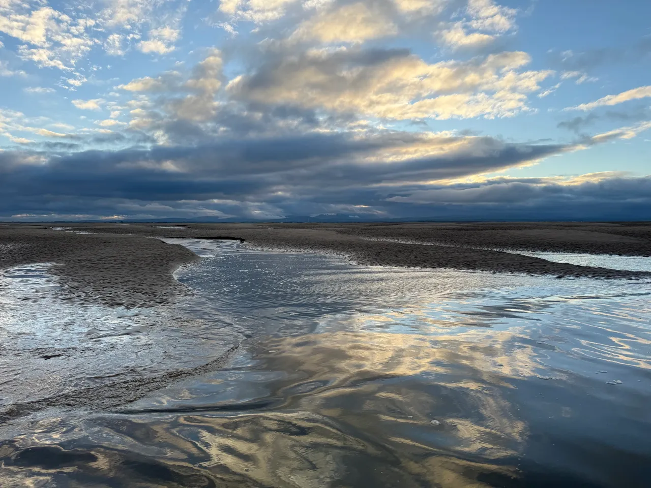
2.6 km, about 1.6 miles later, at 08:12, I crossed into NY0548. The sea was running along the grid square, though not uniformly. I chose a thin spit of sand, walked along it and then waded out a little way. When I turned around, there was a small section of dry land within the square ready for me to capture. It got deep and cold quickly, but the view back towards the Cumbrian Fells made up for it.
NY0547 lay 700 metres further, mostly surrounded by water and soft sand. Conscious of the tide beginning to turn, I jogged towards it, taking several more photos from within NY0548 as I crossed.
I could see ’47 was already starting to disappear. A small area of raised sand remained on the far side of the grid line. I found another sliver of sand, stepped off the end, turned, and captured number two.

A brisk walk back followed, carefully avoiding the darker, softer patches that signal quicksand. Some of the channels were deeper than they looked. I was glad I had worn shorts, but I would definitely be travelling home sitting on a towel to protect the upholstery.
I took a quick drive down to Allonby to try for another promising square, NY0644, but I was about an hour too late.
Back at Holme St Cuthbert, I put the drone up to see where I had been and what might be possible next time.
The Coastline
It is a beautiful, difficult place, constantly changing, part land, part sea, rarely still. At low tide, the high points rise like islands; at high tide, they vanish without trace.
I have been walking and kayaking here for years and still get caught out sometimes, wading back through the channels that were not there an hour earlier. But that is the appeal of the Solway. It never quite reveals itself fully.
Afterword
Two new squares photographed, a few minutes of footage captured, and a reminder that adventure does not always require distance. Sometimes it only needs timing, curiosity, and a willingness to get your feet wet.
Visit my Geograph profile page here
Field Kit from This Trip
Everything I used on the Solway outing — simple, reliable, and tested by mud, tide and mild panic.
As an Amazon Associate, I earn from qualifying purchases.
VHF Radio – ICOM IC-M25 Euro EVO Marine VHF Radio
Small, waterproof, rechargeable. I have used mine for several years, it can easily go a week without losing charge. There’s a reason why most sea kayakers prefer this one.
LED Strobe Beacon – Odeo LED distress flare
Lives on my shoulder strap; bright enough to get noticed without looking tactical.
Satellite Beacon (PLB) – rescueME PLB1 personal locator beacon. Carried on the fells and permanently in my buoyancy aid at sea, more for peace of mind than anything else. This is the subscription-free kind.
iPhone 16 Pro – Used for navigation and most of the footage. Waterproof, tough, simply brilliant.
GoPro Hero 12 – Chest-mounted for hands-free fieldwork and comic realism.
Drone – DJI Mini 2 SE Compact, stable, affordable and still a brilliant tool

Thanks for reading. If you enjoyed this piece, I’d love to hear from you — just drop me a comment below.




Leave a Reply