Category: Adventures

  • Kayaking The River Great Ouse

    Kayaking The River Great Ouse

    (see also my latest trip along the River in this post)

    Plan A was to return to Scotland with our sea kayaks for a week of wild camping.

    A forecast of gales and storms put an end to that, and we had to find a Plan B quickly.

    Nick had recently moved to Willington — a short walk from the River Great Ouse.

    I took a fairly unenthusiastic look at the maps and paddlesports forums to see if it was viable. Gradually, it began to look more interesting.

    The river starts somewhere in Northamptonshire, runs past Oxfordshire, Buckinghamshire, Bedfordshire, Cambridgeshire and Norfolk, and eventually reaches the sea. At around 160 miles long, only a portion is officially navigable — from Kempston to The Wash.

    That navigable stretch is managed by a series of locks. It passes through attractive towns and villages, under the A1(M) and the main railway line, and through large areas of quiet countryside.

    We both needed British Waterways licences for this section, which came with free watercraft insurance — unexpectedly useful.  See here for more info about that.  

    Planning was deliberately loose. My usual speed and distance calculations are based on sea and lake kayaking; a river with locks and portages makes precision difficult. I estimated we were good for roughly twenty miles, which should get us to Godmanchester with some margin.

    We left Nick’s house at about 08:45 on 1 September and carried the boats the half-mile to the put-in.

    We were travelling light — no spare paddles, no camping kit, and, unusually, no beer. Even so, our forearms were burning by the halfway point and we paused twice.

    Two Dagger kayaks sat on the footpath, Nick stood next to them, paddles laid on top ready to go

    We launched at around 09:15. The river was barely moving: flat, green, and enclosed by mature trees. The bends in the channel meant it felt more like paddling a narrow lake.

    Willington Lock appeared quickly. The Environment Agency had installed a canoe portage step, which made getting out straightforward despite the low water levels. After a short carry past the lock, we reached the downstream platform — about a foot and a half above the water — while a floating excavator dredged gravel from the channel.

    Environment Agency floating excavator working next to a barge on dredging operations

    We re-entered by sitting in the kayaks on the platform and sliding in. Not elegant, but it worked.

    By chance rather than design, we reached The River Mill at Eaton Socon at 12:35, just as the rain arrived. It looked slightly upmarket for two damp paddlers, but the staff were welcoming and the fish and chips were excellent. We ate, dried off a little, and carried on.

    The lock at St Neots was the most awkward. Getting out was fine, but the portage crosses a main road and runs down a narrow footpath with no obvious re-entry point. The nearest platform sat about three feet above the water — too high for a controlled slide — so we climbed over a fence and lowered the kayaks down an overgrown bank instead.

    Nick next to a moored cabin cruiser called Nick Nak

    After that, progress was steady. We stopped for a photograph beside a cabin cruiser which looked suspiciously as though it had been designed for Nick.

    By the time we reached Godmanchester, we were both knackered.

    Twenty-one miles (33 km) is a solid paddle in any conditions, but the repeated climbs in and out of the water had been a real workout. This was my first proper trip in the Dagger Katana, and I came away impressed.

    I’ll be back to see more of the river. Next time, I’d like to continue downstream and see how far we can get towards the sea — a quiet, steady journey to add to the growing list of trips we never originally intended.

    Footnote – we did indeed return in 2026 for a 3 day journey – see separate post Kayaking the River Great Ouse: 85km from Willington to Ely

    Paddle Logger screenshot of the route taken.   33.8 km paddled, 7 hours 4 minutes paddling time average speed 4.78 km/h

    Thanks for reading. If you enjoyed this review or spot anything that needs correcting, I’d love to hear from you — just drop me a comment below.
  • Taking the “Y” off Geography – A Morning on the Solway

    Taking the “Y” off Geography – A Morning on the Solway

    “The word Geography is a noun”

    But take the Y off the end and you end up with something altogether different: a verb, an adjective, still a noun, but above all, a quietly brilliant pastime.

    The Geograph project divides the United Kingdom and Ireland into 1 km by 1 km grid squares, 281,952 of them in total. Of those, 84.9% have been photographed by contributors, leaving 48,760 that remain blank.

    Today, I did my bit to reduce that number ever so slightly.

    The Solway Coast

    There are roughly 200 unphotographed squares along the Solway coast. The easy ones, like car parks, viewpoints and beach access points, were claimed years ago. What is left are the awkward ones: out at sea, cut off by channels, or reachable only when the tide decides to cooperate.

    This morning it did.

    Low tide was forecast at 07:55 with a depth of just 0.83 metres, about 1.2 metres lower than usual. On a coast this flat, that difference exposes vast areas that only exist for an hour or two each month.

    Today’s Adventure

    Armed with a GPX file of every unclaimed square within 30 km of home, I had identified two possibilities: NY0548 and NY0547. I recognised a moderate degree of risk in this, but thankfully I have decent safety kit from my other hobby, sea kayaking.

    I packed a VHF radio, LED beacon, satellite beacon and some boating shoes that would not mind getting wet. Everything went into a bright orange dry bag with a shoulder strap. Even if I ended up swimming, my keys would stay dry.

    I parked at Holme St Cuthbert, as close as possible to where I needed to be, and used my iPhone to guide me along the most direct route through channels, rock pools and mussel beds.

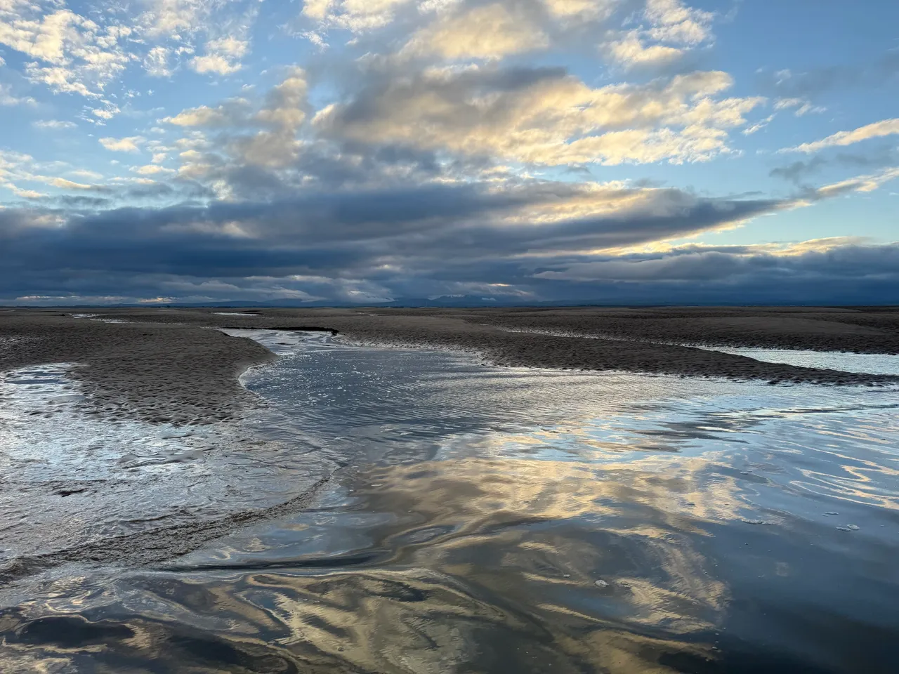
    Beach scene, wet sand reflects the blue sky and clouds.  The fells of the Lake District are visible on the horizon.
    Sea, sky, sand and the distant Lakeland Fells viewed from Stinking Crag

    2.6 km, about 1.6 miles later, at 08:12, I crossed into NY0548. The sea was running along the grid square, though not uniformly. I chose a thin spit of sand, walked along it and then waded out a little way. When I turned around, there was a small section of dry land within the square ready for me to capture. It got deep and cold quickly, but the view back towards the Cumbrian Fells made up for it.

    NY0547 lay 700 metres further, mostly surrounded by water and soft sand. Conscious of the tide beginning to turn, I jogged towards it, taking several more photos from within NY0548 as I crossed.

    I could see ’47 was already starting to disappear. A small area of raised sand remained on the far side of the grid line. I found another sliver of sand, stepped off the end, turned, and captured number two.

    Beach scene, shallow water covers the ground with a small slither of sand visible in the foreground.  The sun is obscured by clouds.
    Solway Coast from Stinking Crag

    A brisk walk back followed, carefully avoiding the darker, softer patches that signal quicksand. Some of the channels were deeper than they looked. I was glad I had worn shorts, but I would definitely be travelling home sitting on a towel to protect the upholstery.

    I took a quick drive down to Allonby to try for another promising square, NY0644, but I was about an hour too late.

    Back at Holme St Cuthbert, I put the drone up to see where I had been and what might be possible next time.

    The Coastline

    It is a beautiful, difficult place, constantly changing, part land, part sea, rarely still. At low tide, the high points rise like islands; at high tide, they vanish without trace.

    I have been walking and kayaking here for years and still get caught out sometimes, wading back through the channels that were not there an hour earlier. But that is the appeal of the Solway. It never quite reveals itself fully.

    Afterword

    Two new squares photographed, a few minutes of footage captured, and a reminder that adventure does not always require distance. Sometimes it only needs timing, curiosity, and a willingness to get your feet wet.

    Visit my Geograph profile page here 

    Field Kit from This Trip

    Everything I used on the Solway outing — simple, reliable, and tested by mud, tide and mild panic.

    Thanks for reading. If you enjoyed this piece, I’d love to hear from you — just drop me a comment below.

  • Isle of Bute

    Isle of Bute

    This piece first appeared on the Dull Men’s Club Facebook page, you can read it here I will re-write it into more of a blog post about the trip in due course…

    In my humble opinion, you cannot beat sea kayaking for simple, honest, slow, decent enjoyment.

    My last trip was a classic. Our boats were packed with 12 cans of beer, food and water for 3 days, camping gear, and a change of clothes.

    We found a perfect uninhabited island off the coast of another island (which was itself off the coast of the British Isles). Is that a level 3 recursive island? 

    We camped on a strip of grass, lit a fire, drank beers, and watched satellites, stars, and meteorites.

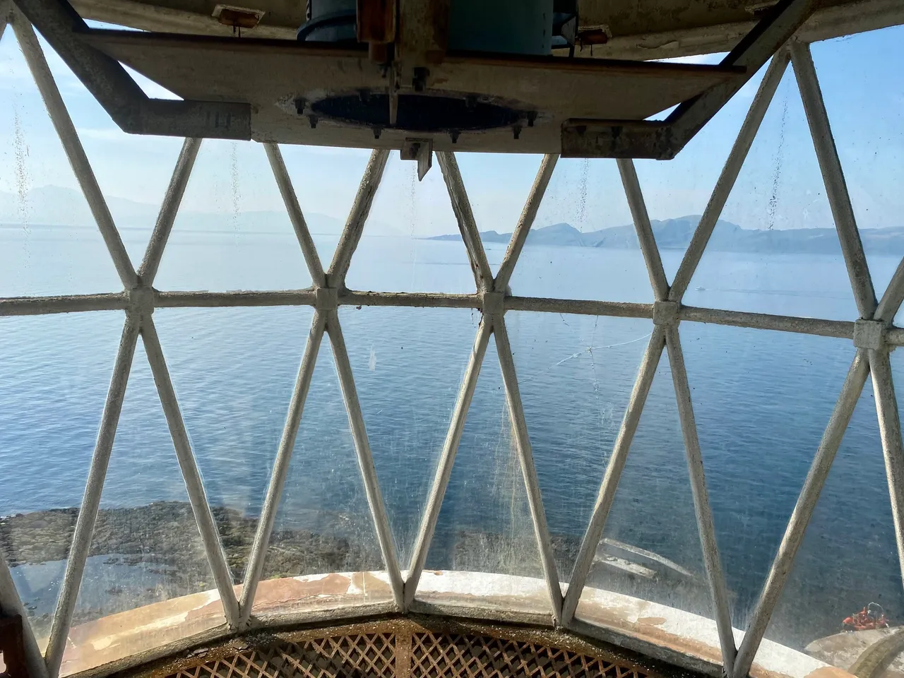
    On day two, we moved on and found ourselves ahead of schedule. As the sea was still, we decided to cross the mile and a half to yet another island. As we got closer, we were very excited to see that the lighthouse had been abandoned. A huge, rusting winch had started to fall down the cliff, and the outbuildings were collapsing in places. Many of the windows in the keeper’s house were missing their glass. The trees and vegetation looked rather too big for their setting.

    We made our boats safe from the rising tide and climbed the 50 or so steps up the cliff face. The lighthouse must have been very important in its day, as there were several large stone buildings and two large, comfortable houses attached to it. One of the buildings still housed a substantial generator (see photo).

    The house doors were all open, so we took a careful look around. I was fascinated to see a Wilkins-Servis Homepride washing machine complete with mangle. Next to it was a Hotpoint spin dryer. Almost everything else had been removed, aside from the odd bit of brown furniture and a dirty mattress.

    We took a look at the lighthouse itself, and I noticed a rack of batteries the size of a van. It said “Don’t use acid” in bold letters—probably good advice.

    There was no litter or graffiti; I guess the location must act as a big filter. I could have spent all week exploring it, but we had to move on with our plans. We did no damage and loved seeing the place. I have the utmost respect for the men and women who lived and worked there when it was a functioning lighthouse. It was an exceptional privilege to go back in time and see a little of their world.

    The rest of our trip was pleasant and uneventful. Another night camping out, we paddled amongst some porpoises. A perfect antidote to daily stresses and petty concerns—I highly recommend giving it a try.

    Diesel generator - clearly not in use, messy coils of cable laying on the floor.  Walls covered in moss paint peeling.

    Thanks for reading. If you enjoyed this report, I’d love to hear from you — just drop me a comment below.